
Page 71 - รายงานการประยุกต์ใช้ฐานข้อมูลการสำรวจระยะไกลจากซอฟต์แวร์รหัสเปิดและคลาวด์คอมพิวติงเพื่องานพัฒนาที่ดิน Utilization of Remote Sensing Database derived from Open-source software and Cloud computing platform for Land Development
P. 71
ห้องสมุดกรมพัฒนาที่ดิน
63
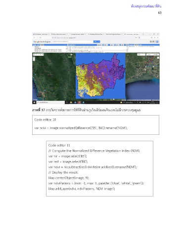
ภาพที่ 37 การวิเคราะห์สภาพการใช้ที่ดินผ่านกูเกิลเอิร์ธเอนจินแบบไม่มีการควบคุมดูแล
Code editor 10
var ndvi = image.normalizedDifference(['B5', 'B4']).rename('NDVI');
Code editor 11
// Compute the Normalized Difference Vegetation Index (NDVI).
var nir = image.select('B5');
var red = image.select('B4');
var ndvi = nir.subtract(red).divide(nir.add(red)).rename('NDVI');
// Display the result.
Map.centerObject(image, 9);
var ndviParams = {min: -1, max: 1, palette: ['blue', 'white', 'green']};
Map.addLayer(ndvi, ndviParams, 'NDVI image');