
Page 66 - รายงานการประยุกต์ใช้ฐานข้อมูลการสำรวจระยะไกลจากซอฟต์แวร์รหัสเปิดและคลาวด์คอมพิวติงเพื่องานพัฒนาที่ดิน Utilization of Remote Sensing Database derived from Open-source software and Cloud computing platform for Land Development
P. 66
ห้องสมุดกรมพัฒนาที่ดิน
58
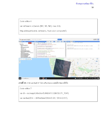
Code editor 6
var visParams = {bands: ['B4', 'B3', 'B2'], max: 0.3};
Map.addLayer(scene, visParams, 'true-color composite');
ภาพที่ 34 ภาพ Landsat 8 TOA reflectance ผสมสีภาพแบบสีจริง
Code editor 7
var l8 = ee.ImageCollection('LANDSAT/LC08/C01/T1_TOA');
var landsat2016 = l8.filterDate('2016-01-01', '2016-12-31');
Map.addLayer(landsat2016, visParams, 'l8 collection');