
Page 72 - รายงานการประยุกต์ใช้ฐานข้อมูลการสำรวจระยะไกลจากซอฟต์แวร์รหัสเปิดและคลาวด์คอมพิวติงเพื่องานพัฒนาที่ดิน Utilization of Remote Sensing Database derived from Open-source software and Cloud computing platform for Land Development
P. 72
ห้องสมุดกรมพัฒนาที่ดิน
64
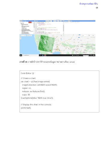
ภาพที่ 38 ภาพดัชนี NDVI ที่ค านวณจากข้อมูลภาพถ่ายดาวเทียม Lansat
Code Editor 12
// Create a chart.
var chart = ui.Chart.image.series({
imageCollection: withNDVI.select('NDVI'),
region: roi,
reducer: ee.Reducer.first(),
scale: 30
}).setOptions({title: 'NDVI over time'});
// Display the chart in the console.
print(chart);