
Page 65 - รายงานการประยุกต์ใช้ฐานข้อมูลการสำรวจระยะไกลจากซอฟต์แวร์รหัสเปิดและคลาวด์คอมพิวติงเพื่องานพัฒนาที่ดิน Utilization of Remote Sensing Database derived from Open-source software and Cloud computing platform for Land Development
P. 65
ห้องสมุดกรมพัฒนาที่ดิน
57
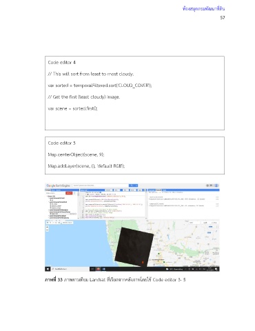
Code editor 4
// This will sort from least to most cloudy.
var sorted = temporalFiltered.sort('CLOUD_COVER');
// Get the first (least cloudy) image.
var scene = sorted.first();
Code editor 5
Map.centerObject(scene, 9);
Map.addLayer(scene, {}, 'default RGB');
ภาพที่ 33 ภาพดาวเทียม Landsat ที่เรียกจากคลังภาพโดยใช้ Code editor 3- 5